Using advanced JavaScript to create dynamic d3.json map earthquakes.
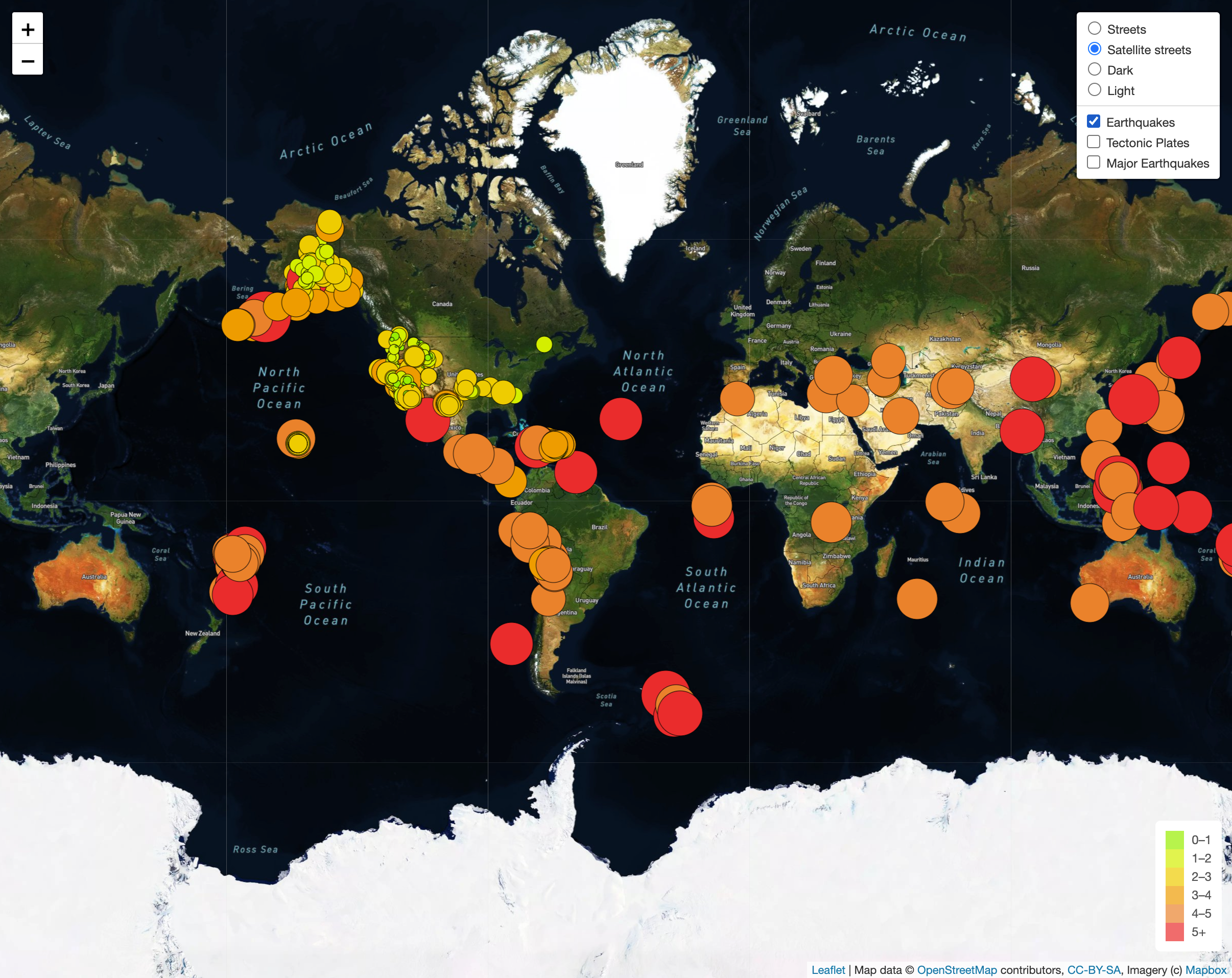
The purpose of this project is to visually see the differnces between earthquakes and magnitudes from all over the world in the last seven days.
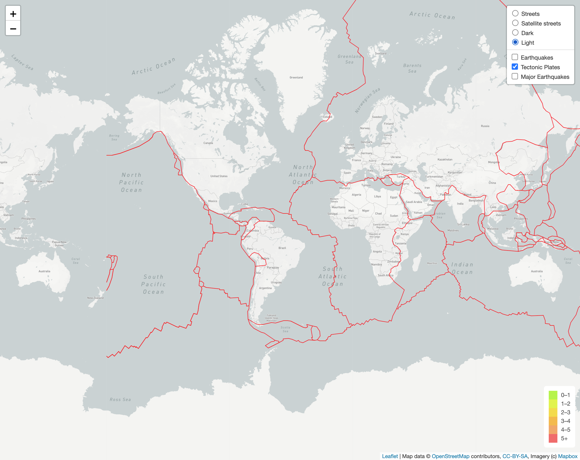
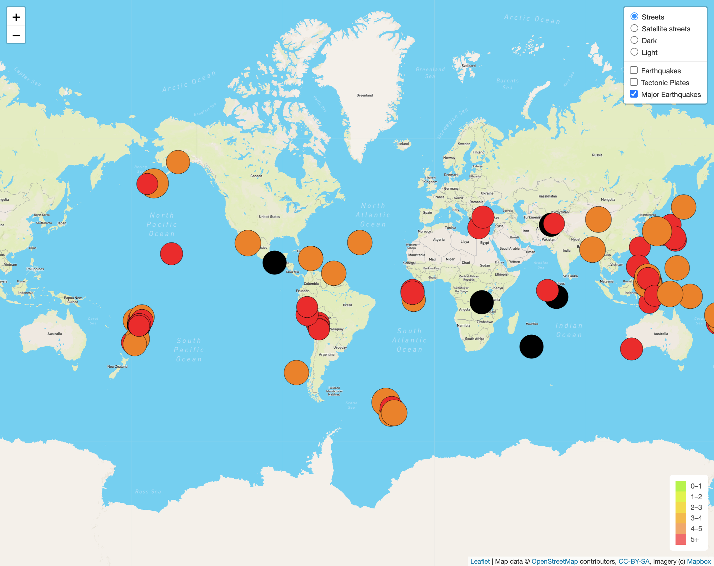
This GeoJSON map has been designed to feature map layers that can switch map views (Street, StreetSatellite, Dark, & Light). It also allows you to choose from three level datas that can be switched on and off following:
- All Earthquakes: Displays all earthquakes in the past seven days.
- Major Earthquakes: Dispalys all major earth quakes and their locations.
- Tectonic Plates: Shows and overview of earths platonics.
- JavaScript, HTML, VS Code 1.63.2
- MapBox
- Leaflet.js